


Bayonne city ward 3 voting district 19, Hudson County, New Jersey
About
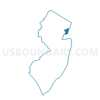
Outline

Summary
| Unique Area Identifier | 618981 |
| Name | Bayonne city ward 3 voting district 19 |
| County | Hudson County |
| State | New Jersey |
| Area (square miles) | 1.16 |
| Land Area (square miles) | 0.23 |
| Water Area (square miles) | 0.94 |
| % of Land Area | 19.37 |
| % of Water Area | 80.63 |
| Latitude of the Internal Point | 40.69055070 |
| Longtitude of the Internal Point | -74.11244370 |
Maps


Graphs
Select a template below for downloading or customizing gragh for Bayonne city ward 3 voting district 19, Hudson County, New Jersey


Neighbors
Neighoring Voting District (by Name) Neighboring Voting District on the Map
- Bayonne city ward 2 voting district 8, Hudson County, NJ
- Bayonne city ward 3 voting district 10, Hudson County, NJ
- Bayonne city ward 3 voting district 13, Hudson County, NJ
- Bayonne city ward 3 voting district 14, Hudson County, NJ
- Bayonne city ward 3 voting district 15, Hudson County, NJ
- Bayonne city ward 3 voting district 18, Hudson County, NJ
- Bayonne city ward 3 voting district 4, Hudson County, NJ
- Jersey City city ward A voting district 5, Hudson County, NJ
- Jersey City city ward A voting district 6, Hudson County, NJ
- Jersey City city ward A voting district 7, Hudson County, NJ
- Jersey City city ward A voting district 8, Hudson County, NJ
- Newark city ward East voting district 3, Essex County, NJ
- Newark city ward East voting district 9, Essex County, NJ
Top 10 Neighboring County Subdivision (by Population) Neighboring County Subdivision on the Map
- Newark city, Essex County, NJ (277,140)
- Jersey City city, Hudson County, NJ (247,597)
- Bayonne city, Hudson County, NJ (63,024)
Top 10 Neighboring Place (by Population) Neighboring Place on the Map
Top 10 Neighboring Unified School District (by Population) Neighboring Unified School District on the Map
- Newark City School District, NJ (277,140)
- Jersey City School District, NJ (247,597)
- Bayonne City School District, NJ (63,024)
Top 10 Neighboring State Legislative District Lower Chamber (by Population) Neighboring State Legislative District Lower Chamber on the Map
Top 10 Neighboring State Legislative District Upper Chamber (by Population) Neighboring State Legislative District Upper Chamber on the Map
Top 10 Neighboring 111th Congressional District (by Population) Neighboring 111th Congressional District on the Map
Top 10 Neighboring Census Tract (by Population) Neighboring Census Tract on the Map
- Census Tract 61, Hudson County, NJ (6,745)
- Census Tract 106, Hudson County, NJ (6,544)
- Census Tract 54, Hudson County, NJ (6,161)
- Census Tract 101, Hudson County, NJ (5,614)
- Census Tract 105, Hudson County, NJ (5,208)
- Census Tract 9802, Essex County, NJ (1,173)